

Olympics
Backcountry Avalanche Forecast
Author: Dennis D'Amico
Issued: Saturday, February 28, 2026 at 6:35 PM PST
Expires: Sunday, March 1, 2026 at 6:00 PM PST
The Bottom Line
 The Bottom Line
Treat steep open slopes, especially on shady aspects at mid/upper elevations with caution due to a known weak layer ~2' down in the upper snowpack. No recent avalanches have been reported on this layer, but large avalanches are still occurring in parts of the Cascades with a similar snowpack structure. If you experience collapsing, whumpfing, or other signs of instability, retreat to simpler terrain. In areas where the snow becomes wet and mushy, stay out of very steep and extreme terrain.
Avalanche Danger
Sunday, March 1, 2026
6500-5500ft2 - Moderate

5500-4500ft2 - Moderate
4500-3000ft2 - Moderate
Monday, March 2, 2026
6500-5500ft0 - No Rating

5500-4500ft0 - No Rating
4500-3000ft0 - No Rating
Avalanche Danger ScaleLearn moreGeneral InfoGeneral Information1 - LowLow2 - ModModerate3 - ConsConsiderable4 - HighHigh5 - ExtrExtreme
 1 - Low | 2 - Moderate |  3 - Considerable |  4 - High |  5 - Extreme | |
|---|---|---|---|---|---|
| Travel Advice | Generally safe avalanche conditions. Watch for unstable snow on isolated terrain features. | Heightened avalanche conditions on specific terrain features. Evaluate snow and terrain carefully; identify features of concern. | Dangerous avalanche conditions. Careful snowpack evaluation, cautious route-finding and conservative decision-making essential. | Very dangerous avalanche conditions. Travel in avalanche terrain not recommended. | Extraordinarily dangerous avalanche conditions. Avoid all avalanche terrain. |
| Likelihood of Avalanches | Natural and human-triggered avalanches unlikely. | Natural avalanches unlikely; human-triggered avalanches possible. | Natural avalanches possible; human-triggered avalanches likely. | Natural avalanches likely; human-triggered avalanches very likely. | Natural and human-triggered avalanches certain. |
| Avalanche Size and Distribution | Small avalanches in isolated areas or extreme terrain. | Small avalanches in specific areas; or large avalanches in isolated areas. | Small avalanches in many areas; or large avalanches in specific areas; or very large avalanches in isolated areas. | Large avalanches in many areas; or very large avalanches in specific areas. | Very large avalanches in many areas. |
Avalanche Problems (2)
Problem #1: Persistent Slab
Problem Type
Persistent Slab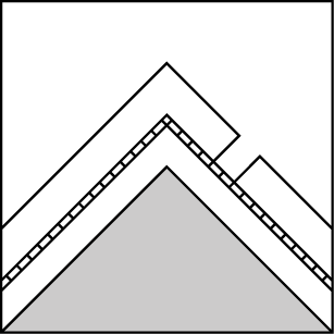
Aspect/Elevation
Likelihood
Size
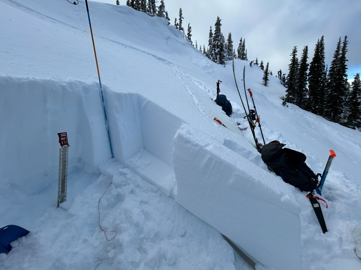
(2/26/2026)
A propagation saw test (PST) result of 79/100. End on an N aspect near Steeple Rock. This snowpack test gauges the likelihood of a fracture to propagate on a known weak layer (buried surface hoar). Numbers below 50 indicate a higher likelihood of fracture propagation. PSTs from Saturday on northerly aspects of Hurricane Hill produced similar results.
Snowpack tests like this can be helpful for identifying which slopes to avoid, but they are only one piece of information from a single location. They should not be used to deem a suspect slope "safe".
Photo: Sam Luthy - NPS
Earlier in the week, the snowpack was giving off flashing signs of instability, with NPS staff experiencing collapses and whumpfing in terrain near ridgelines. After several days without a new avalanche, but with the same snowpack structure, we've entered an uncomfortable space where triggering a persistent slab avalanche has become less likely, but the consequences are still severe. A few reports from the Hurricane area on Saturday said backcountry travellers felt uncomfortable with the snowpack on more committing northerly aspects and turned around. Sometimes that's worth more than a snowpack test.
Continue treating all open steep slopes on shady aspects as suspect until proven otherwise. If you experience any collapsing or whumpfing, remotely trigger avalanches, or see other signs of instability, retreat to simpler terrain. Don't be lured into more consequential terrain by the nice weather, stick to shaded, wind-sheltered terrain and slopes under 35 degrees.
Well-identified weak layers (buried surface hoar and or/facets) are down about 2' at mid-elevations and found just above a prominent crust (2/13) in the upper snowpack. This layering is most likely to be found on shady aspects at mid and upper-elevations, even right below ridgelines.
Persistent slabs are notorious for surprising backcountry travelers; they break more widely across the slope and can be triggered from lower-angle terrain than run-of-the-mill storm slab avalanches. Dig and look for the buried surface hoar/facets above the 2/13 crust to help rule out slopes, and consider using snowpack tests to gain more information, but do not use results to deem a suspect slope "safe" or not.
Problem #2: Wet Loose
Problem Type
Wet Loose
Aspect/Elevation
Likelihood
Size
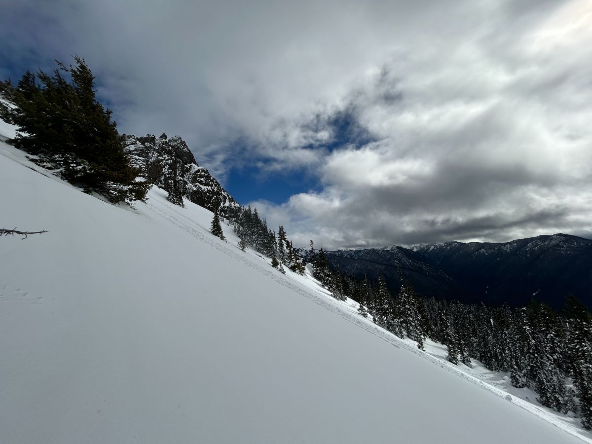
(2/26/2026)
Roller balls started to release on a south aspect near Steeple rock during periods of sunshine.
These are often precursors to wet loose avalanches.
Photo: Sam Luthy - NPS
A mild Saturday night followed by a mostly sunny Sunday should lead to surface crusts breaking down quickly on Sunday. Wet loose avalanches won't be an issue on slopes exposed to strong west winds that have firm textured surfaces.
Rollerballs, pinwheels, and wet sluffs fanning out below your feet or machine are obvious clues that the snow surface is becoming wet and weak. In isolated areas, these wet loose avalanches could grow large if they run far and entrain weaker wet snow below. Avoid travel above or below terrain traps where wet loose avalanches may release. You can always move to shadier aspects without exposure as the warming commences. Give cornices a large berth when travelling along ridgelines.
Forecast Discussion
On Saturday, NPS and backcountry travelers in the Hurricane Ridge area reported firm, wind-textured snow along and below ridgelines, transitioning to softer snow lower down in north-facing terrain. Southerly aspects were beginning to melt out again after a few days of mild temperatures and sunshine.
Several natural avalanche crowns from within the last week were visible in the Hurricane Ridge area and also the Bailey Range. Some crowns in the Bailey Range were further downslope than usual, evidence of the strong westerly winds over much of the week and potentially of the underlying weak snowpack structure.
The new snow has drastically improved the snow coverage, even at lower elevations. However, this snow fell on bare ground in some places. Travel in the woods, lower elevations, and on previously melted-out slopes will still present travel obstacles. Travel cautiously in these areas to avoid injury.
This is an unusual snowpack setup for the Olympics and we need your observations! Share what you see with us, we love photos and clear descriptions. Read the neighboring Cascade zones to see how persistent slabs and an extended period of strong winds are leading to dangerous conditions in many areas.
This information is provided by the U.S.D.A. Forest Service and describes general backcountry avalanche hazard and conditions.
It does not apply to ski areas and highways where avalanche mitigation is conducted.