

West Slopes Central
Backcountry Avalanche Forecast
Author: Irene Henninger
Issued: Monday, March 9, 2026 at 6:30 PM PDT
Expires: Tuesday, March 10, 2026 at 6:30 PM PDT
The Bottom Line
 The Bottom Line
Snow from the last 48 hours will vary across the zone, with up to two feet in the Highway 2 area and the south side of the Mountain Loop, whereas farther north, it may be closer to a foot. Expect to trigger larger and more destructive avalanches in wind-loaded areas, so identify heavier, drifted snow and avoid these areas with depths greater than 8-10" over the crust. Even in non wind-loaded spots, loose dry avalanches will run on steep slopes.
Avalanche Danger
Tuesday, March 10, 2026
7500-5500ft3 - Considerable

5500-4500ft3 - Considerable
4500-2500ft2 - Moderate

Wednesday, March 11, 2026
7500-5500ft4 - High

5500-4500ft3 - Considerable
4500-2500ft2 - Moderate
Avalanche Danger ScaleLearn moreGeneral InfoGeneral Information1 - LowLow2 - ModModerate3 - ConsConsiderable4 - HighHigh5 - ExtrExtreme
 1 - Low | 2 - Moderate | 3 - Considerable | 4 - High |  5 - Extreme | |
|---|---|---|---|---|---|
| Travel Advice | Generally safe avalanche conditions. Watch for unstable snow on isolated terrain features. | Heightened avalanche conditions on specific terrain features. Evaluate snow and terrain carefully; identify features of concern. | Dangerous avalanche conditions. Careful snowpack evaluation, cautious route-finding and conservative decision-making essential. | Very dangerous avalanche conditions. Travel in avalanche terrain not recommended. | Extraordinarily dangerous avalanche conditions. Avoid all avalanche terrain. |
| Likelihood of Avalanches | Natural and human-triggered avalanches unlikely. | Natural avalanches unlikely; human-triggered avalanches possible. | Natural avalanches possible; human-triggered avalanches likely. | Natural avalanches likely; human-triggered avalanches very likely. | Natural and human-triggered avalanches certain. |
| Avalanche Size and Distribution | Small avalanches in isolated areas or extreme terrain. | Small avalanches in specific areas; or large avalanches in isolated areas. | Small avalanches in many areas; or large avalanches in specific areas; or very large avalanches in isolated areas. | Large avalanches in many areas; or very large avalanches in specific areas. | Very large avalanches in many areas. |
Avalanche Problems (2)
Problem #1: Wind Slab
Problem Type
Wind Slab
Aspect/Elevation
Likelihood
Size
Wind slabs are likely to avalanche with a human trigger on Tuesday. Search for heavier-feeling snow beneath you, and look for textured surfaces or thicker, smooth, and rounded pillows of snow. You're most likely to find newly developed slabs around rocky outcroppings and other features, in gullies, and on the leeward side of ridges or subridges. In some areas, only a subtle change in the terrain is enough to build thicker, reactive drifts in one spot, stripping snow from surfaces only a few feet away.
If you encounter bullseye clues like long, shooting cracks, that's a clear warning sign to avoid steep slopes. Natural avalanches are possible. Steer around steep, wind-drifted slopes on Tuesday.
Although tougher to initiate, there may be mid-storm interfaces that you could trigger a slab avalanche on in non wind-loaded areas.
Problem #2: Dry Loose
Problem Type
Dry Loose
Aspect/Elevation
Likelihood
Size
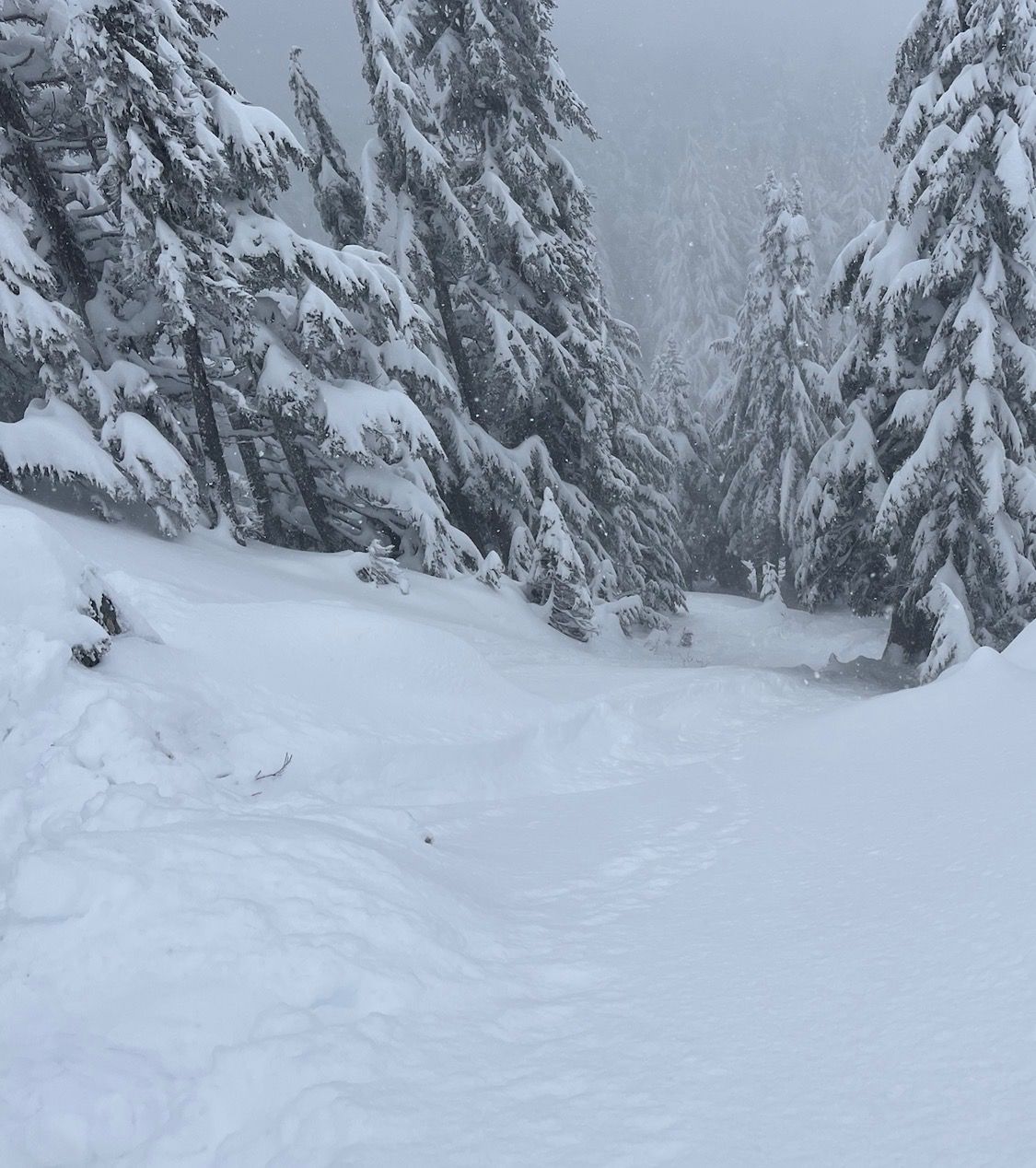
In very steep spots, especially in areas with gullies, large amounts of loose dry snow ran far. You can see the grooves the sluffs cut out.
Photo: Irene HenningerNon wind-loaded steep slopes are likely to produce "sluffs", or loose dry avalanches in the abundance of low-density snow that exists. Some sluffs may run naturally, but if you enter steep terrain, you're likely to initiate one of these avalanches.
A loose dry avalanche may remain shallow, only impacting the top few inches of snow. Or in areas where a slide becomes more funnelled, like in a gully, the sluff could gouge deeper, possibly down to the underlying crust. One of these slides may not be enough to bury you, but you wouldn't want to get caught in it, especially in areas where a terrain trap could amplify the consequences of getting caught.
Forecast Discussion
A crust beneath the new snow will be noticeable in areas with a thinner new snow layer. The new layer is probably well bonded to the underlying crust. Before temperatures cooled, there were lingering concerns for wet slab avalanches with the several inches of rain that saturated the snow before the surface froze. We no longer suspect that large avalanches will fail naturally on deeper weak layers, although it's not completely out of the question that a large cornice fall could trigger a larger avalanche on a deeper layer.
The convergence zone targeted the Hwy 2 corridor early Monday morning, and weather stations in that area recorded 1-1.5" of water, translating to 12-18" of snow. During the day, snowfall amounts appeared to favor the north side of the Mtn Loop, where up to six inches fell, with closer to one or two inches further south. Forecasts are calling for another six inches Monday night, and an inch or two on Tuesday. Snow and warmer temperatures are in the forecast for Wednesday, with an uptick in avalanche danger.
There are hidden hazards that now have a foot or two of light, dry snow further disguising them. Beware of mysterious holes surrounding rocks, hidden trees, and creek holes. These are in abundance even in the mid elevations, given the shallow snowpack that exists this year.
This information is provided by the U.S.D.A. Forest Service and describes general backcountry avalanche hazard and conditions.
It does not apply to ski areas and highways where avalanche mitigation is conducted.