

West Slopes Central
Backcountry Avalanche Forecast
Author: Lee Lazzara
Issued: Friday, March 13, 2026 at 6:30 PM PDT
Expires: Saturday, March 14, 2026 at 6:30 PM PDT
The Bottom Line
 The Bottom Line
The storm will have moved on by Saturday morning, but large quantities of snow remain in the southern half of West Central. Stick to conservative, lower-angled terrain if you find more than a foot of new snow. Sunbreaks could set the stage for loose snow avalanches initiating from cliffs and other steep terrain features. Avalanche danger is the greatest along the Highway 2 corridor down to I-90.
Avalanche Danger
Saturday, March 14, 2026
7500-5500ft3 - Considerable

5500-4500ft3 - Considerable
4500-2500ft2 - Moderate

Sunday, March 15, 2026
7500-5500ft2 - Moderate
5500-4500ft2 - Moderate
4500-2500ft1 - Low

Avalanche Danger ScaleLearn moreGeneral InfoGeneral Information1 - LowLow2 - ModModerate3 - ConsConsiderable4 - HighHigh5 - ExtrExtreme
1 - Low | 2 - Moderate | 3 - Considerable |  4 - High |  5 - Extreme | |
|---|---|---|---|---|---|
| Travel Advice | Generally safe avalanche conditions. Watch for unstable snow on isolated terrain features. | Heightened avalanche conditions on specific terrain features. Evaluate snow and terrain carefully; identify features of concern. | Dangerous avalanche conditions. Careful snowpack evaluation, cautious route-finding and conservative decision-making essential. | Very dangerous avalanche conditions. Travel in avalanche terrain not recommended. | Extraordinarily dangerous avalanche conditions. Avoid all avalanche terrain. |
| Likelihood of Avalanches | Natural and human-triggered avalanches unlikely. | Natural avalanches unlikely; human-triggered avalanches possible. | Natural avalanches possible; human-triggered avalanches likely. | Natural avalanches likely; human-triggered avalanches very likely. | Natural and human-triggered avalanches certain. |
| Avalanche Size and Distribution | Small avalanches in isolated areas or extreme terrain. | Small avalanches in specific areas; or large avalanches in isolated areas. | Small avalanches in many areas; or large avalanches in specific areas; or very large avalanches in isolated areas. | Large avalanches in many areas; or very large avalanches in specific areas. | Very large avalanches in many areas. |
Avalanche Problems (1)
Problem #1: Storm Slab
Problem Type
Storm Slab
Aspect/Elevation
Likelihood
Size
(2/17/2026)
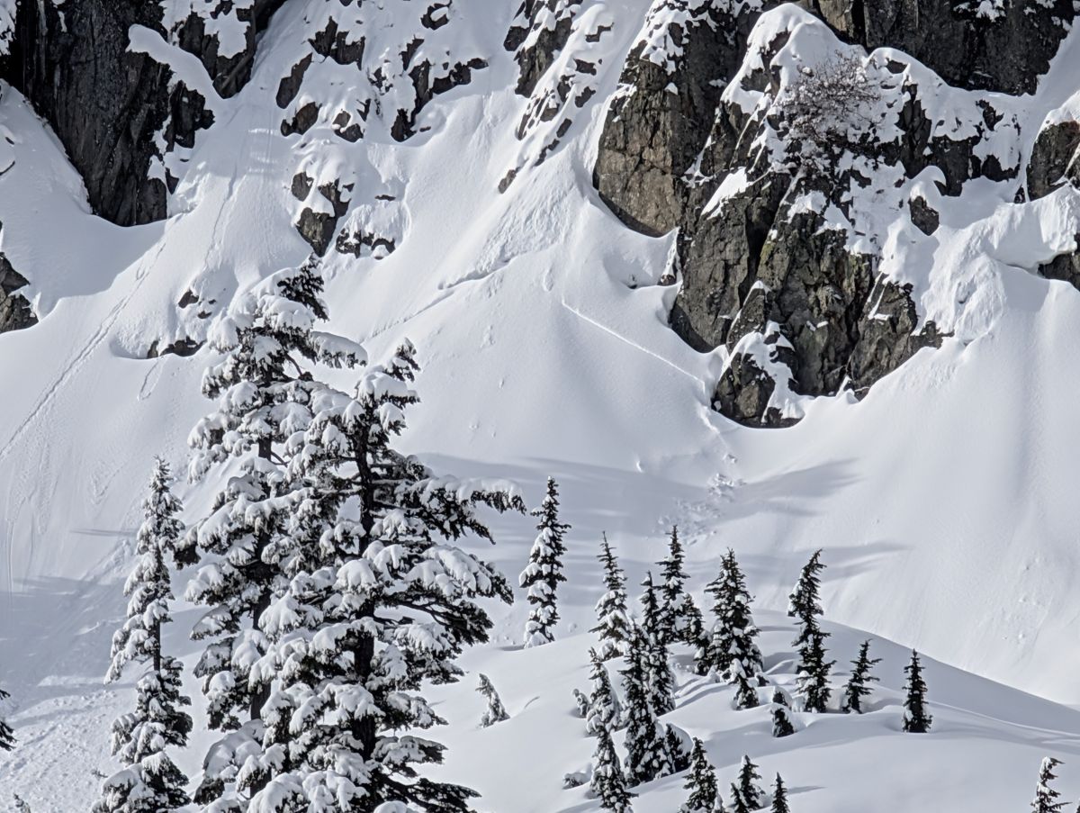
Snow sluffing off cliffs can trigger a slab on the slope below.
Photo: Andy Harrington
Large quantities of snow fell in the Central Cascades over the past 48 hours, with 3 or more feet at both Snoqualmie and Stevens Pass. Snowfall amounts are expected to be similar along the Highway 2 corridor down to I-90, with lesser amounts in the northern Mountain Loop and Darrington. It’s not guaranteed that the new snow will stay unstable enough for widespread natural or human-triggered avalanches on Saturday, but the quantity of new snow is too much to ignore.
The best gauge for terrain selection will be how much new snow you find. Deep? Just stick to simpler, lower-angled terrain. If amounts are more modest then assess stability using the usual tools: slope tests and other simple assessment methods to determine how well the new snow layers are bonded. Whatever you find, don’t ignore obvious red flags like shooting cracks or recent avalanches.
If wind speeds increase, then expect to find fresh wind slabs on leeward slopes. Drifting snow will be the main sign of active transport. Monitor snow depth and stiffness as you gain elevation and change aspects. You are much more likely to trigger an avalanche on slopes with recent wind loading.
Forecast Discussion
The sun is not forecast to make much of an appearance on Saturday, but if it does, be ready to see loose wet avalanches initiating from steep rocky terrain. Keep track of what’s going on overhead as the day warms.
Loose dry avalanches should also be on your radar. Expect to push some snow downhill with you if you descend or traverse steep slopes. Natural loose dry avalanches are also possible below cliffs and other very steep features. These sluffs are unlikely to bury you, but could push you around or carry you somewhere you don’t want to go.
The Cascades are in the unique situation of seeing extreme variation in avalanche danger over a short distance. While West North observers felt avalanche danger was limited and quite easy to anticipate, numerous natural and human-triggered avalanches, sympathetic releases, and closed highways were reported from Stevens Pass and other zones. With this in mind, be prepared to find conditions quite different from what has been stated here if heading to less traveled parts of the forecast zone.
This information is provided by the U.S.D.A. Forest Service and describes general backcountry avalanche hazard and conditions.
It does not apply to ski areas and highways where avalanche mitigation is conducted.