

West Slopes Central
Backcountry Avalanche Forecast
Author: Irene Henninger
Issued: Thursday, March 26, 2026 at 6:30 PM PDT
Expires: Friday, March 27, 2026 at 6:30 PM PDT
The Bottom Line
 The Bottom Line
Steep, wind-drifted slopes at higher elevations are where you're most likely to trigger an avalanche that could kill you. Search for heavier, drifted snow on large, steep slopes and steer around these areas, especially if there are obvious clues like long, shooting cracks. Wet loose avalanches are expected to run on steep slopes facing the sun, so steer around those slopes when they get soggy and wet, or if you notice rollerballs or wet slides.
Avalanche Danger
Friday, March 27, 2026
7500-5500ft2 - Moderate

5500-4500ft2 - Moderate
4500-2500ft1 - Low

Saturday, March 28, 2026
7500-5500ft2 - Moderate
5500-4500ft1 - Low
4500-2500ft1 - Low
Avalanche Danger ScaleLearn moreGeneral InfoGeneral Information1 - LowLow2 - ModModerate3 - ConsConsiderable4 - HighHigh5 - ExtrExtreme
1 - Low | 2 - Moderate |  3 - Considerable |  4 - High |  5 - Extreme | |
|---|---|---|---|---|---|
| Travel Advice | Generally safe avalanche conditions. Watch for unstable snow on isolated terrain features. | Heightened avalanche conditions on specific terrain features. Evaluate snow and terrain carefully; identify features of concern. | Dangerous avalanche conditions. Careful snowpack evaluation, cautious route-finding and conservative decision-making essential. | Very dangerous avalanche conditions. Travel in avalanche terrain not recommended. | Extraordinarily dangerous avalanche conditions. Avoid all avalanche terrain. |
| Likelihood of Avalanches | Natural and human-triggered avalanches unlikely. | Natural avalanches unlikely; human-triggered avalanches possible. | Natural avalanches possible; human-triggered avalanches likely. | Natural avalanches likely; human-triggered avalanches very likely. | Natural and human-triggered avalanches certain. |
| Avalanche Size and Distribution | Small avalanches in isolated areas or extreme terrain. | Small avalanches in specific areas; or large avalanches in isolated areas. | Small avalanches in many areas; or large avalanches in specific areas; or very large avalanches in isolated areas. | Large avalanches in many areas; or very large avalanches in specific areas. | Very large avalanches in many areas. |
Avalanche Problems (2)
Problem #1: Wind Slab
Problem Type
Wind Slab
Aspect/Elevation
Likelihood
Size
(3/26/2026)
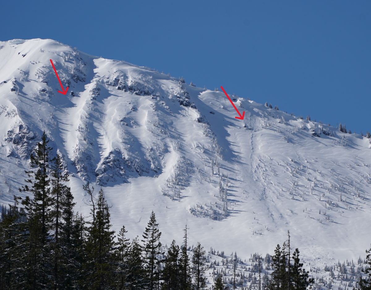
Cross-loaded, wind-textured snow and a partially filled-in crown of an avalanche (D2) in the neighboring Stevens Pass zone from Thursday. 6,900ft, N-NE
Photo: Josh Hirshberg
You could trigger an avalanche in wind-drifted snow that formed on Wednesday. Slabs were found to be reactive in neighboring zones. They've since slowly stabilized, but especially at higher elevations, you could still cause an avalanche on a steep, unsupported slope.
Search for wind-affected snow. Wind slabs may be smooth and rounded, or they could have a textured surface. These areas will feel firmer beneath you than softer, non wind-affected snow. Slabs frequently develop in gullies, on the leeward side of ridges and features, and around outcroppings. Look for obvious clues like long, shooting cracks, and dig small hand pits to see how easily the heavier, wind-affected layer slides over the softer snow beneath it. Avoid steep slopes where you encounter wind slabs, and especially if you find obvious clues that are concerning.
Problem #2: Wet Loose
Problem Type
Wet Loose
Aspect/Elevation
Likelihood
Size
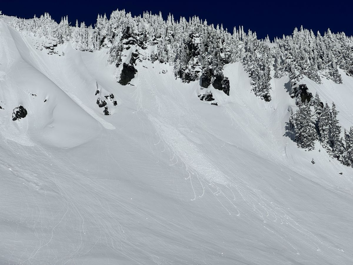
Example photo: Wet loose avalanches like these ones could occur on Friday. They might be larger and more destructive. Photo: Annie Spence
There were small amounts of wet loose avalanche activity on Thursday, and a crust may have formed on some slopes that were wetted. More solar input is expected on Friday, and temperatures are expected to climb higher than the previous day, so there could be an uptick in wet loose avalanche activity. Expect the most activity from rocky areas.
Steep slopes facing the sun will get sloppy and wet, and could slide. If you notice rollerballs, slides, or are surrounded by wet, sticky snow, shift to lower-angle terrain away from the bottom of large paths facing the sun, or move to a colder aspect.
Forecast Discussion
Around three inches of water came in with this storm Tuesday through early Thursday morning. Early on, there was some waffling between rain and snow at mid-elevations, but thankfully, the last bit of precipitation fell as snow. Strong winds formed slabs earlier in the storm, but the last bit of snow that fell may have been non-wind-affected, disguising wind slabs. You could still feel a shift to dense- feeling snow beneath the light coating of snow on top, if wind slabs are diguised.
If you're in high-consequence terrain like areas above rocks, cliffs, trees, or a gully, being caught in even a small slide could result in a bad outcome. We have limited information from the West Central zone, so be sure to investigate the snowpack for yourself, or, when in doubt, avoid steep terrain with wind-affected snow.
I went to Lake Serene on Thursday (observation), and was greeted by 6-8" of cold, low-density snow above 2000ft. The intense sun quickly melted snow below that elevation and wetted any other slopes it hit. The steep, cliffy east-facing walls above Lake Serene had constant "sluffs", or small loose avalanches running down them as the sunlight heated the cliffs. Most activity in this extreme terrain likely occurred on Thursday, since there was new snow, but expect continued loose avalanches in areas like this and on any steep slopes facing the sun on Friday.
This information is provided by the U.S.D.A. Forest Service and describes general backcountry avalanche hazard and conditions.
It does not apply to ski areas and highways where avalanche mitigation is conducted.