

West Slopes North
Backcountry Avalanche Forecast
Author: Irene Henninger
Issued: Monday, March 2, 2026 at 6:00 PM PST
Expires: Tuesday, March 3, 2026 at 6:00 PM PST
The Bottom Line
 The Bottom Line
Precipitation rates will increase through the day, and avalanche danger will rise with them. New wind-drifted snow at higher elevations may become reactive this afternoon, so avoid steep slopes with six inches or more of freshly drifted snow. While conditions vary across the zone, a low-probability but high-consequence chance of large avalanches remains—consider steering away from steep upper-elevation terrain near ridgelines and large start zones, especially north of 542.
Avalanche Danger
Tuesday, March 3, 2026
7500-5500ft3 - Considerable

5500-4500ft2 - Moderate

4500-2500ft1 - Low

Wednesday, March 4, 2026
7500-5500ft3 - Considerable
5500-4500ft3 - Considerable
4500-2500ft2 - Moderate
Avalanche Danger ScaleLearn moreGeneral InfoGeneral Information1 - LowLow2 - ModModerate3 - ConsConsiderable4 - HighHigh5 - ExtrExtreme
1 - Low | 2 - Moderate | 3 - Considerable |  4 - High |  5 - Extreme | |
|---|---|---|---|---|---|
| Travel Advice | Generally safe avalanche conditions. Watch for unstable snow on isolated terrain features. | Heightened avalanche conditions on specific terrain features. Evaluate snow and terrain carefully; identify features of concern. | Dangerous avalanche conditions. Careful snowpack evaluation, cautious route-finding and conservative decision-making essential. | Very dangerous avalanche conditions. Travel in avalanche terrain not recommended. | Extraordinarily dangerous avalanche conditions. Avoid all avalanche terrain. |
| Likelihood of Avalanches | Natural and human-triggered avalanches unlikely. | Natural avalanches unlikely; human-triggered avalanches possible. | Natural avalanches possible; human-triggered avalanches likely. | Natural avalanches likely; human-triggered avalanches very likely. | Natural and human-triggered avalanches certain. |
| Avalanche Size and Distribution | Small avalanches in isolated areas or extreme terrain. | Small avalanches in specific areas; or large avalanches in isolated areas. | Small avalanches in many areas; or large avalanches in specific areas; or very large avalanches in isolated areas. | Large avalanches in many areas; or very large avalanches in specific areas. | Very large avalanches in many areas. |
Avalanche Problems (3)
Problem #1: Wind Slab
Problem Type
Wind Slab
Aspect/Elevation
Likelihood
Size
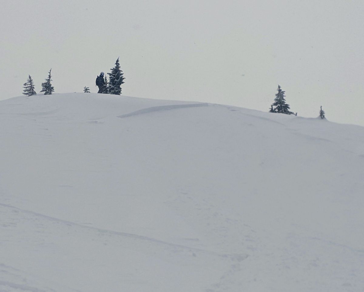
Example photo: It's likely for you to trigger small avalanches on newly drifted deposits of snow, like in this photo. Photo: Adam Ü
As new snow accumulates through the day, the likelihood of triggering avalanches in freshly wind-drifted snow will increase. Snowlines will gradually fall, but this problem will mainly affect upper elevations, possibly expanding into mid elevations later.
Look for smooth, rounded drifts or firm, textured snow on the leeward sides of ridges, in gullies, and around terrain features. Avoid steep slopes where these deposits are present, especially if you notice cracking or recent small avalanches. Even small slides could have serious consequences in steep or confined terrain—and on large, smooth slopes, they may step down into a deeper, more dangerous avalanche.
Problem #2: Persistent Slab
Problem Type
Persistent Slab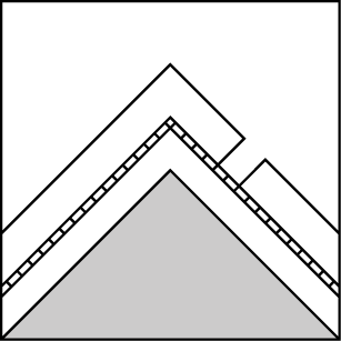
Aspect/Elevation
Likelihood
Size
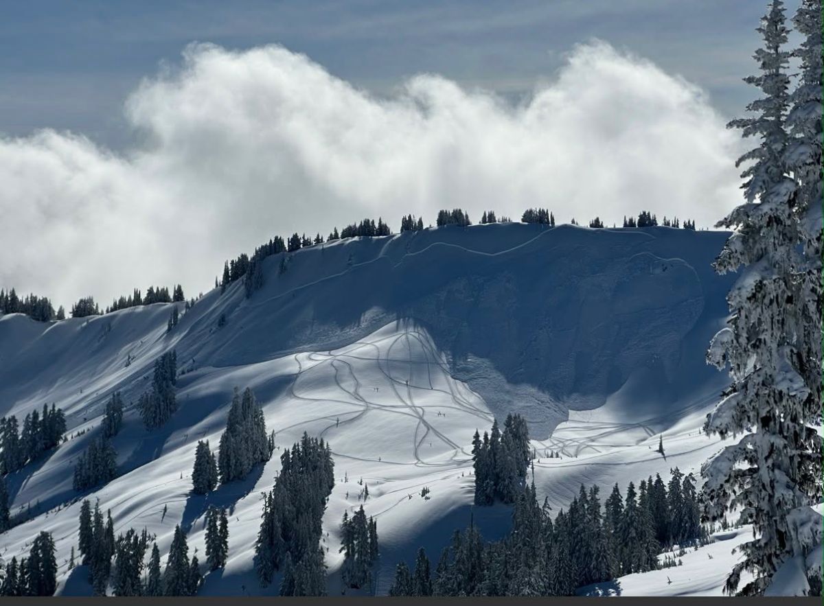
A large, rider-triggered avalanche in the Canyon Creek area that happened Sunday. This likely occurred on a persistent layer, seeing how far it propagated. The rider managed to accelerate out of the slide. We appreciate their sharing with us.
Our persistent slab problem varies widely across the zone. Some well-traveled areas have seen little to no avalanche activity, while others have produced natural, remote, and human-triggered avalanches. Many recent avalanches are failing near a thin mid-February crust buried under roughly two feet of snow in most areas and up to four feet in the Baker backcountry. Buried surface hoar has also been identified, with most larger avalanches occurring on northerly aspects.
Classic warning signs like collapses, whumphing, and shooting cracks are strong indicators of instability, though deeper weak layers may produce few clues. Uncertainty increases in less-traveled terrain, so consider checking for weak snow above crusts before committing to large slopes. Choosing lower-angle, less wind-loaded terrain remains the simplest way to reduce risk.
Problem #3: Wet Loose
Problem Type
Wet Loose
Aspect/Elevation
Likelihood
Size
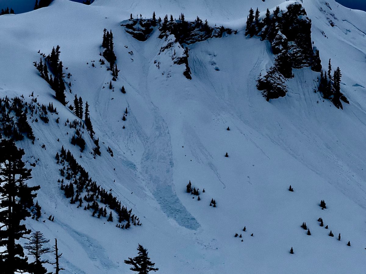
Example photo: Wet loose avalanches like this may run in any remaining low density snow, most likely on shady slopes, on Tuesday. Bagley Basin. N, 5000ft.
Photo: Zack McGill - Cascade Mtn Ascents
Precipitation will begin with a relatively high snowline, bringing rain to most mid and lower elevations through the day. South-facing slopes have already been warm and wet, so additional avalanche activity there is unlikely. Shadier slopes, however, may be getting wet for the first time, where wet loose avalanches could occur.
Many exposed areas of dry snow have firm, wind-affected surfaces that are less likely to produce wet avalanches. But in previously sheltered terrain still holding soft, low-density snow, rain may quickly create wet, sticky surface snow capable of sliding—starting as rollerballs and possibly small wet loose avalanches. If you see signs of wet activity, avoid similar steep slopes nearby.
Forecast Discussion
Forecasts call for about a half inch of water equivalent on Tuesday, mainly in the afternoon, falling mostly as snow at upper elevations. Temperatures will begin to cool, though surfaces will remain soft and wet rather than refreezing into a crust.
Over the weekend, travelers covered much of the zone—thank you to everyone who shared observations. Conditions varied widely by location. Near-low-danger conditions were reported around Schriebers on the south side of Mount Baker (observation), while observers near the Cascade River noted limited wet loose activity and a few recent slabs on south aspects triggered by small wet slides (observation). Widespread wind-hammered snow from last week’s strong west winds was also noted.
Recent persistent slab activity has been isolated but consequential. Aside from one large and one very large natural avalanche in the Baker backcountry (observation) (observation), most activity has occurred in wind-loaded terrain near Excelsior Ridge and on Chowder Ridge between Skyline and Hadley Peak. The takeaway is variability: most slopes appear stable, but isolated wind-loaded higher areas are still capable of producing large avalanches. A lack of recent activity is encouraging, but not a green light for large alpine terrain.
This information is provided by the U.S.D.A. Forest Service and describes general backcountry avalanche hazard and conditions.
It does not apply to ski areas and highways where avalanche mitigation is conducted.