

West Slopes North
Backcountry Avalanche Forecast
Author: Irene Henninger
Issued: Sunday, March 8, 2026 at 6:30 PM PDT
Expires: Monday, March 9, 2026 at 6:30 PM PDT
The Bottom Line
 The Bottom Line
It'll be windy on Monday, and you're likely to trigger an avalanche in newly wind-drifted snow. Beneath the new layer, firm surfaces will likely exist, and any drifts or deposits thicker than a few inches may slide easily on the underlying crust.
Avalanche Danger
Monday, March 9, 2026
7500-5500ft3 - Considerable

5500-4500ft2 - Moderate

4500-2500ft2 - Moderate
Tuesday, March 10, 2026
7500-5500ft3 - Considerable
5500-4500ft2 - Moderate
4500-2500ft2 - Moderate
Avalanche Danger ScaleLearn moreGeneral InfoGeneral Information1 - LowLow2 - ModModerate3 - ConsConsiderable4 - HighHigh5 - ExtrExtreme
 1 - Low | 2 - Moderate | 3 - Considerable |  4 - High |  5 - Extreme | |
|---|---|---|---|---|---|
| Travel Advice | Generally safe avalanche conditions. Watch for unstable snow on isolated terrain features. | Heightened avalanche conditions on specific terrain features. Evaluate snow and terrain carefully; identify features of concern. | Dangerous avalanche conditions. Careful snowpack evaluation, cautious route-finding and conservative decision-making essential. | Very dangerous avalanche conditions. Travel in avalanche terrain not recommended. | Extraordinarily dangerous avalanche conditions. Avoid all avalanche terrain. |
| Likelihood of Avalanches | Natural and human-triggered avalanches unlikely. | Natural avalanches unlikely; human-triggered avalanches possible. | Natural avalanches possible; human-triggered avalanches likely. | Natural avalanches likely; human-triggered avalanches very likely. | Natural and human-triggered avalanches certain. |
| Avalanche Size and Distribution | Small avalanches in isolated areas or extreme terrain. | Small avalanches in specific areas; or large avalanches in isolated areas. | Small avalanches in many areas; or large avalanches in specific areas; or very large avalanches in isolated areas. | Large avalanches in many areas; or very large avalanches in specific areas. | Very large avalanches in many areas. |
Avalanche Problems (2)
Problem #1: Wind Slab
Problem Type
Wind Slab
Aspect/Elevation
Likelihood
Size
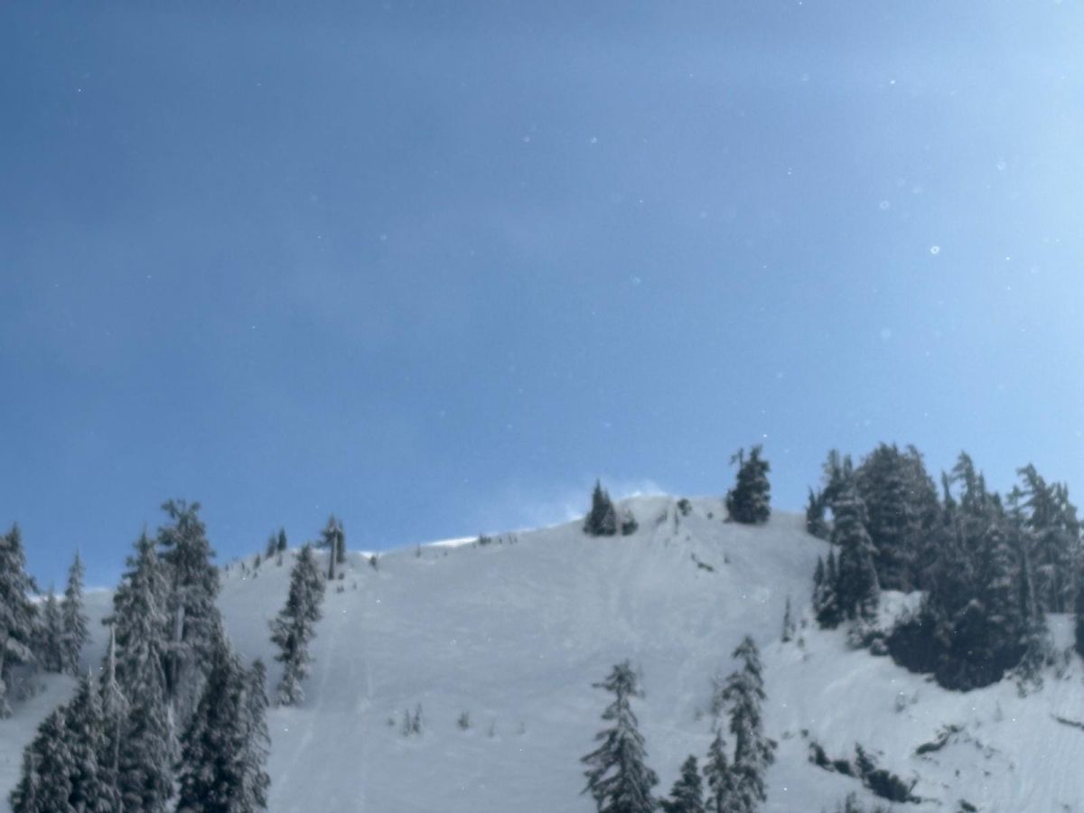
(3/8/2026)
Extensive wind transport in the small amount of new snow that fell above 5000ft as temperatures cooled in the Baker backcountry. Search for flagging along ridgelines, like this, as obvious clues to avoid slopes beneath these areas.
Photo: Julz Holder - Grounding Truth
Strong winds will redistribute snow into drifts, possibly a foot or deeper in places. Deposits tend to form around rocky outcroppings and other features, in gullies, and on the leeward side of ridges or subridges. Sometimes, only a subtle change in the terrain is enough to build thicker, reactive drifts in one spot, stripping snow from surfaces only a few feet away.
Search for smooth, rounded drifts or textured surfaces to help you identify wind slabs. Look for actively blowing snow and notice where the snow lands. Steer around steep, wind-drifted slopes on Monday.
Sunday night and on Monday, we'll get about six inches of snow. This will be enough for small drifts down low, and potentially larger ones at higher elevations, where more precipitation landed as snow earlier in the storm.
Problem #2: Wet Slab
Problem Type
Wet Slab
Aspect/Elevation
Likelihood
Size
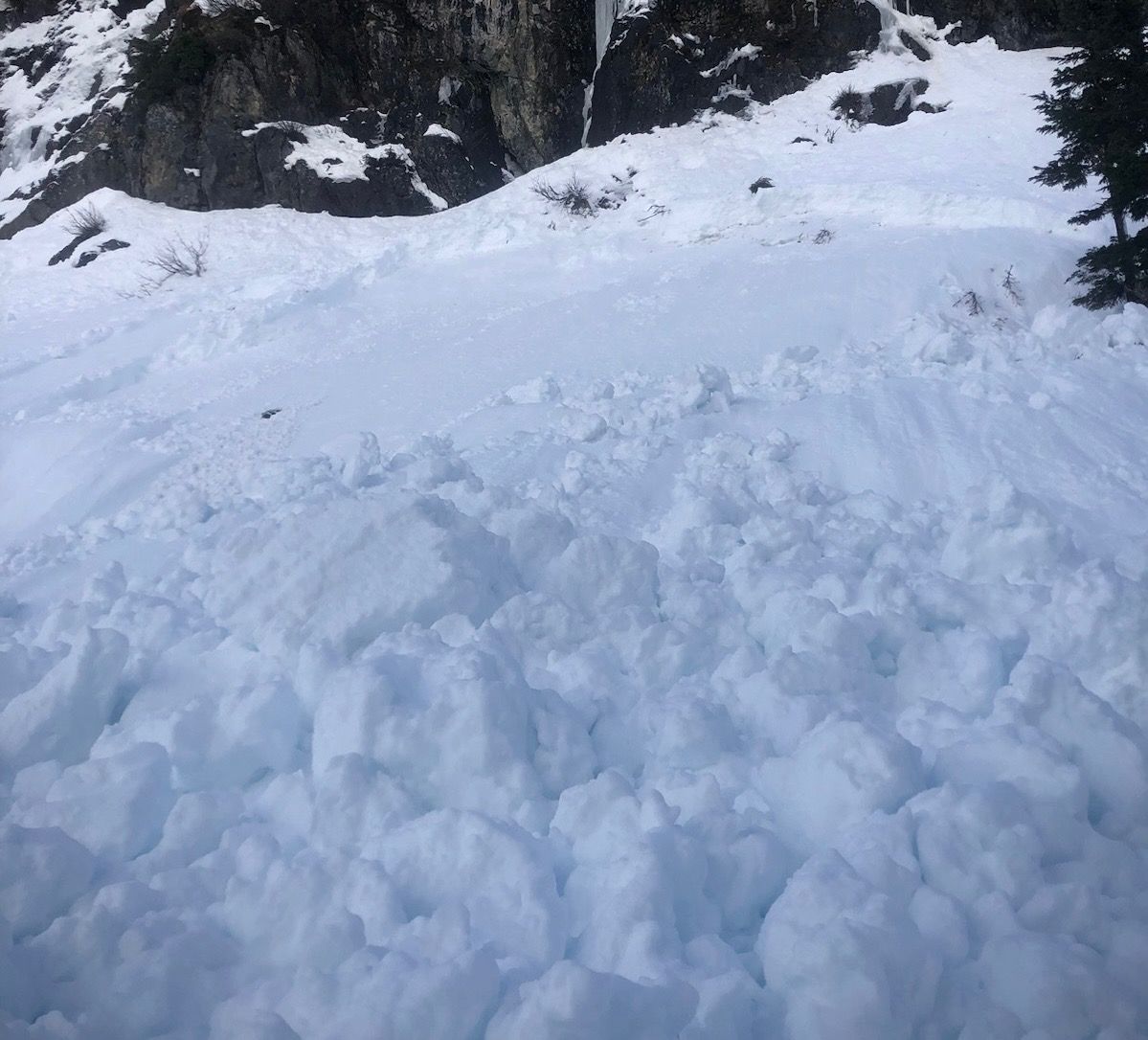
A large wet slab avalanche released at 6am in the morning in previously unskied terrain, after a 3-hour period that resulted in over .75" of rain. The slab was reported as having a 30" crown, likely failing on one of our underlying weak layers that are progressively healing.
Photo: Mt Baker Ski PatrolThere was far more rain and warmer temperatures than we expected Saturday night through Sunday morning. A couple of wet slab avalanches released early morning in the Mt Baker Ski Area vicinity, after over .75" of rain was recorded at Heather Meadows in a period of 3 hours. Several observers in the Baker backcountry saw one additional small wet slab in the Corner Pocket area at about 5000ft on an east-facing slope.
We expect that with the freeze that finally arrived midday Sunday, any lingering weaknesses in underlying layers will quickly lock up. Wet slabs do have a habit of remaining very unpredictable, however, so we're keeping this as a problem for another day, despite the solid surface crust quickly forming.
There could be lingering cornice falls or a glide crack or two opening up as cooling happens. Beware of traveling beneath large overhead hazards like large, saggy cornices, recently wrinkled snow, or newly opened glide cracks. As for wet slabs, it's hard to pinpoint where they may happen. Consider traveling quickly beneath large, open slopes during your outing. Any wet slab failures would be a low-probability, high-consequence scenario: if you were caught in one, it would probably kill you.
Forecast Discussion
A midday clearing occurred Sunday as temperatures plummeted. Crusts formed on surfaces. In areas where the crust formed, incoming snow may not stick well to the underlying crust. Slabs could slide easily on the firm surface, or likewise, low-density snow that falls with these cold temperatures could "sluff", or slide easily, as loose dry avalanches.
An abundance of rollerballs were found on nearly all steep slopes during the cloud break on Sunday. They mainly occurred Friday night as temperatures reached above freezing. Beware variable, bumpy hard surfaces in areas beneath the new snow.
This information is provided by the U.S.D.A. Forest Service and describes general backcountry avalanche hazard and conditions.
It does not apply to ski areas and highways where avalanche mitigation is conducted.