

West Slopes North
Backcountry Avalanche Forecast
Author: Irene Henninger
Issued: Tuesday, March 10, 2026 at 6:30 PM PDT
Expires: Wednesday, March 11, 2026 at 6:30 PM PDT
The Bottom Line
 The Bottom Line
Avalanche danger will ramp up as the day progresses. Up to six inches of snow could fall overnight, and similar amounts during the day, with an abrupt temperature increase, meaning rain at lower elevations, plus extreme winds in the afternoon, creating very dangerous conditions. Starting out, wind-drifted snow will avalanche with a human trigger, so avoid steep wind loaded slopes, but by midday, steer around large avalanche paths and lower-angle slopes beneath them.
Avalanche Danger
Wednesday, March 11, 2026
7500-5500ft4 - High

5500-4500ft4 - High
4500-2500ft3 - Considerable

Thursday, March 12, 2026
7500-5500ft4 - High
5500-4500ft4 - High
4500-2500ft3 - Considerable
Avalanche Danger ScaleLearn moreGeneral InfoGeneral Information1 - LowLow2 - ModModerate3 - ConsConsiderable4 - HighHigh5 - ExtrExtreme
 1 - Low |  2 - Moderate | 3 - Considerable | 4 - High |  5 - Extreme | |
|---|---|---|---|---|---|
| Travel Advice | Generally safe avalanche conditions. Watch for unstable snow on isolated terrain features. | Heightened avalanche conditions on specific terrain features. Evaluate snow and terrain carefully; identify features of concern. | Dangerous avalanche conditions. Careful snowpack evaluation, cautious route-finding and conservative decision-making essential. | Very dangerous avalanche conditions. Travel in avalanche terrain not recommended. | Extraordinarily dangerous avalanche conditions. Avoid all avalanche terrain. |
| Likelihood of Avalanches | Natural and human-triggered avalanches unlikely. | Natural avalanches unlikely; human-triggered avalanches possible. | Natural avalanches possible; human-triggered avalanches likely. | Natural avalanches likely; human-triggered avalanches very likely. | Natural and human-triggered avalanches certain. |
| Avalanche Size and Distribution | Small avalanches in isolated areas or extreme terrain. | Small avalanches in specific areas; or large avalanches in isolated areas. | Small avalanches in many areas; or large avalanches in specific areas; or very large avalanches in isolated areas. | Large avalanches in many areas; or very large avalanches in specific areas. | Very large avalanches in many areas. |
Avalanche Problems (2)
Problem #1: Storm Slab
Problem Type
Storm Slab
Aspect/Elevation
Likelihood
Size
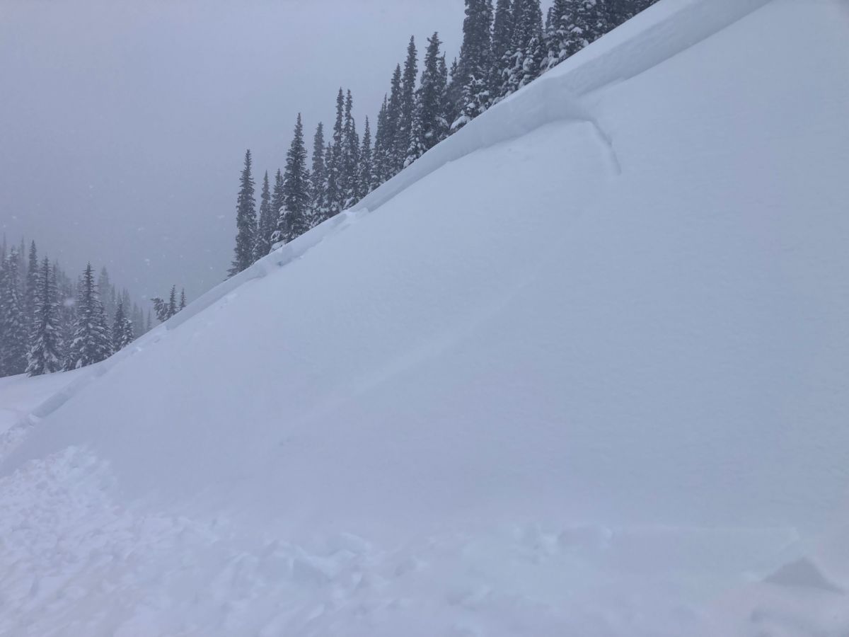
Example photo: Slab avalanches like these are expected to release naturally in the afternoon. Don't travel beneath steep slopes, where one could run down and bury you.
Early in the day, avalanches will likely be limited to human-triggered wind slabs. Avoid steep wind-loaded slopes. Expect danger to rise quickly as temperatures climb, snowfall continues, and winds increase to gale force. By midday and beyond, natural avalanches will become more likely. With rapidly increasing loading, avoid traveling beneath large avalanche paths.
Avalanches may start out shallower, but potentially well over a foot deep where wind loading occurs. As the day progresses, many could fail on the 3/8 crust buried beneath the snow that has fallen since Sunday. This is likely 6-18 inches in non wind loaded areas throughout the zone.
Problem #2: Wet Loose
Problem Type
Wet Loose
Aspect/Elevation
Likelihood
Size
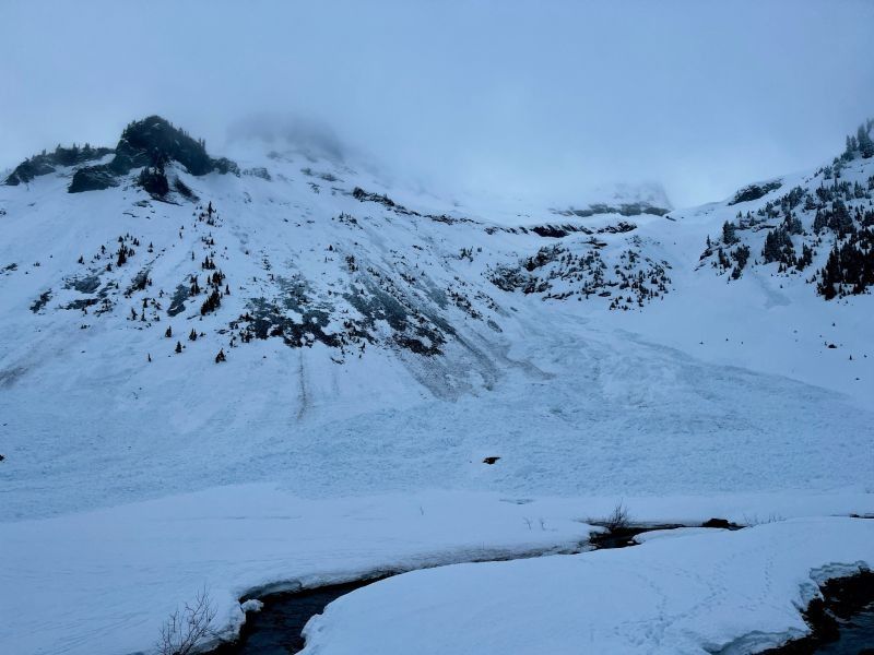
Example photo: A combination of slabs and wet loose avalanches will happen as temperatures increase and snow gets wet. Avalanches could run far, down to flat areas beneath steep paths. Avoid these areas.
We don’t expect wet avalanche activity until around midday. After that, wet avalanches will begin creeping higher in elevation, possibly reaching mid-elevations by afternoon as rain and heavy, wet snow saturate the surface.
At first, wet avalanches will probably require a trigger like a person on a slope, or by snow shedding from trees, cliffs, and steep rocky slopes. There could also be a mix of storm slab avalanches initiated by heavy, wet snow at the surface.
Once the snow turns sticky and starts shedding naturally—likely around midday—it’s time to back off steep terrain. Move to lower-angle slopes and stay well clear of large slopes above you where snow could run down to you.
Forecast Discussion
At lower elevations, avalanches will likely be smaller and won't run as easily in areas with more broken bed surfaces since there was less old snow cover at these elevations. If there are areas with sufficient cover near the top of the lower elevation band, in particular in the Heather Meadows area, treat these areas similarly to higher elevations by steering around the bottom of large avalanche paths.
In the Heather Meadows area, the 3/8 crust sits about a foot down, while in the Sisters, it has been reported as closer to 3" deep, even at upper elevation. This likely means lower danger there or in other areas with a thinner layer above the crust, as avalanches will be smaller. As for the crust, in many steep areas, it is already irregular after widespread rollerballs ran before it froze, so we're not quite sure how easily slides will run on the crust.
Sunday morning, before temperatures cooled, there were a couple wet slab avalanches that ran on older underlying weak areas in the Mount Baker Ski Area vicinity. We've had a subsequent freeze, and the resulting 3/8 crust. We don't expect failures beneath the 3/8 crust, but if layers get wet enough that the crust is completely soft, although unlikely, there's a chance a large avalanche could trigger an even larger one on this layer.
We're expecting up to six inches Tuesday night, and another 6-8" during the day- although some will fall as rain at mid and lower elevations. Winds will peak, reaching gale force, Wednesday afternoon. That night, we'll see the highest precipitation rates, although temperatures will cool. We expect natural avalanches to continue or peak Wednesday night.
This information is provided by the U.S.D.A. Forest Service and describes general backcountry avalanche hazard and conditions.
It does not apply to ski areas and highways where avalanche mitigation is conducted.